The remarkable consistency of positional information is clearly evident in the survey of a Landing Craft Tank (LCT-524) in about 18 m of water off Utah Beach. The vessel is well preserved with a number of recognizable features including the bow ramp, 20-mm gun mounts, and debris in the hold. A large scour pit can also be seen on the port side indicating strong local current regime (Fig. 11). If we look at the individual soundings associated with two crossings of the vertical gunnels of the vessel, color coded by line number (Fig. 12), we see that sonar hits on the vertical wall are typically within a few cm of each other and never more than 50 cm apart, indicating a high degree of precision in the horizontal positioning. We assume that we were able to achieve this degree of precision due to the fact that the overlapping lines were collected within a few minutes of each other (typically less than 20 minutes) and within this time period the GPS satellite geometry remained stable. We did notice occasions where there were sudden (small) offsets in the position of vertical targets (resulting in an apparent double hull) and these cases appeared to be related to a change in the satellite constellation.
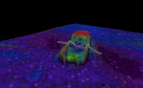
Reson 8125 survey of LCT 524, gridded at 25 cm and rendered in 3-D. Cross-section represents the region from which soundings were extracted and displayed below.
Figure 11

Soundings from two separate lines crossing LCT 524. Color represents the individual lines. Note the consistency of position of the soundings on the gunnels from line to line. Grid cells represent 50 cm distance.
Figure 12