Line Islands, Kingman Palmyra, Pacific Ocean Highlights
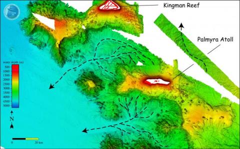
Map view of area between Kingman Reef and Palmyra Atoll showing extensive channel system developed in water depths of ~4500 m. DTMs of Kingman Reef and Palmyra Atoll proper from NOAA Pacific Islands Benthic Habitat Mapping Center data.
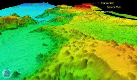
Perspective view of the northern Line Island ridge, looking NW. Vertical exaggeration 3x. Note extensive landslides in the background (see Kingman Landslides) and small, apparently young, volcanic cones throughout the ridge. DTMs of Kingman Reef and Palmyra Atoll proper from NOAA Pacific Islands Benthic Habitat Mapping Center data.
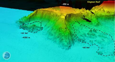
Perspective view of the Kingman Reef pedestal with large landslides and the debris deposits from the landslides (outlined with dashed polygons). The water depths at the top of the pedestal are ~350 m and the basin floor is ~4350 m deep. DTM of Kingman Reef proper from NOAA Pacific Islands Benthic Habitat Mapping Center data. View is looking N, vertical exaggeration 3x.