
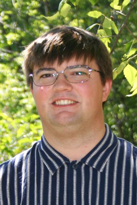
Ashley Advincula
Philippines
Ashley Advincula holds a Bachelor’s degree in Electronics and Communications Engineering from the University of the Philippines. She began her career in the power supply industry before discovering her passion for seabed mapping. She gained valuable experience in hydrography while working with the national mapping agency of the Philippines, where she conducted both shallow- and deep-water bathymetric surveys mainly for the creation of nautical charts that support safe navigation.
Before joining CCOM, she worked as a surveyor mapping deep-sea environments, including the Tonga Trench and South Shetland Trough. She aims to grow as a knowledgeable and effective hydrographic surveyor while pursuing FIG/IHO/ICA Category A certification. Outside of work, she enjoys outdoor adventures, cozy exploration and sandbox-style computer games, and a bit of Pokémon.

Lucia Cattana
Argentina
Lucía Cattana, an officer of the Argentine Navy and a geologist, graduated from the National University of Río Cuarto. Since 2022, she has led the Geodetic Networks and Photogrammetry divisions at the Naval Hydrographic Service, contributing to the delimitation of maritime spaces, the definition of Argentina’s international boundaries, and the processing of photogrammetric flights and bathymetric data for the production of nautical charts.
She has complemented her training with courses in hydrography, marine geology, and deep-sea mining, and has participated in multiple oceanographic campaigns.
For Lucía, participating in the GEBCO program represents a unique opportunity to deepen her knowledge in hydrography and marine cartography, advance ocean science, and strengthen the scientific and technical capabilities of her institution.
Outside of her professional work, she enjoys hiking and cycling, combining her passion for science with a love for nature and time spent with friends.

Felicity Dennis
Australia
Felicity Dennis is a Hydrographic Surveyor with experience across marine and infrastructure projects. She has worked on major tunneling projects in Australia and now contributes to coastal and offshore surveying at Revelare Hydrospatial. Felicity earned the 2024 South Australia GCA Diversity and Inclusion Award and holds a Bachelor of Applied Science (Surveying) (Honours) from RMIT University in Melbourne, Victoria. Through the GEBCO program, Felicity aims to strengthen her contributions to offshore projects, environmental monitoring, and sustainable development, while advancing professional capacity-building by mentoring the next generation of surveyors. Outside of work, she enjoys hiking, theatre and music events, as well as knitting and embroidery.
James Peter Harris
Denmark
James Peter Harris is from Bristol in the United kingdom. He moved to Denmark in 2016 to attain his B.Sc. in Electronics and Computer engineering (2019), and M.Sc. in Signal Processing and Acoustics (2022) at Aalborg University. Since graduating, he has worked at the Danish Hydrographic Office and has been working with bathymetric data management and crowd-sourced bathymetry projects.
As a novice in ocean mapping, James found the GEBCO scholar program to give a strong theoretical and practical foundation to ocean mapping and hopes to contribute to ongoing data quality and collection challenges in the future.
In his free time James enjoys photography and can often be found with a camera (sometimes several cameras), or processing film from previous trips.
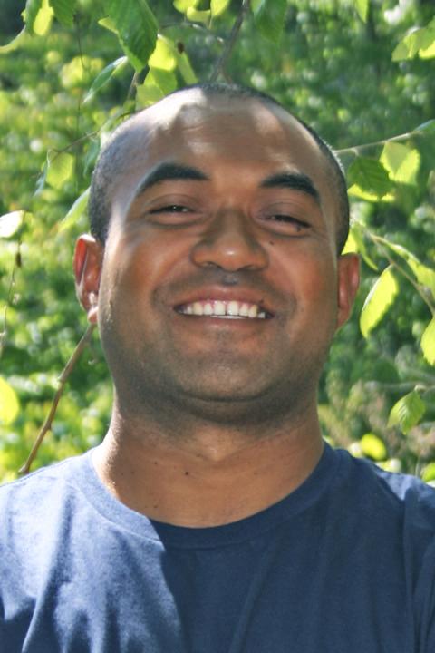
Koroi Seniroqa
Fiji
Koroi Lesikikabara Seniroqa is a disaster management expert from Fiji with extensive expertise in seismology, tsunami early warning systems, and community resilience. He holds a master’s degree in Disaster Management from the National Graduate School of Policy Studies (GRIPS) in Japan and a postgraduate diploma in Tsunami Disaster Mitigation from the International Institute of Seismology and Earthquake Engineering (Japan). He is focused on improving tsunami early warning systems in Fiji. Koroi specializes in tsunami modelling using TUNAMI software with GEBCO bathymetry data. Through the GEBCO program, he aims to learn about ocean mapping and how it can be used to improve tsunami modelling results.