You are here
Research Areas
Research Projects
PROJECT CONTACT
Necker Ridge - Images
- Necker Ridge Foothills of the Mid-Pacific Mountain
- Necker Ridge Southern Guyot
- Necker Ridge Flows
- Necker Ridge Southern Guyot Spur
- Necker Ridge Landslide
- Necker Ridge Bend in Trend
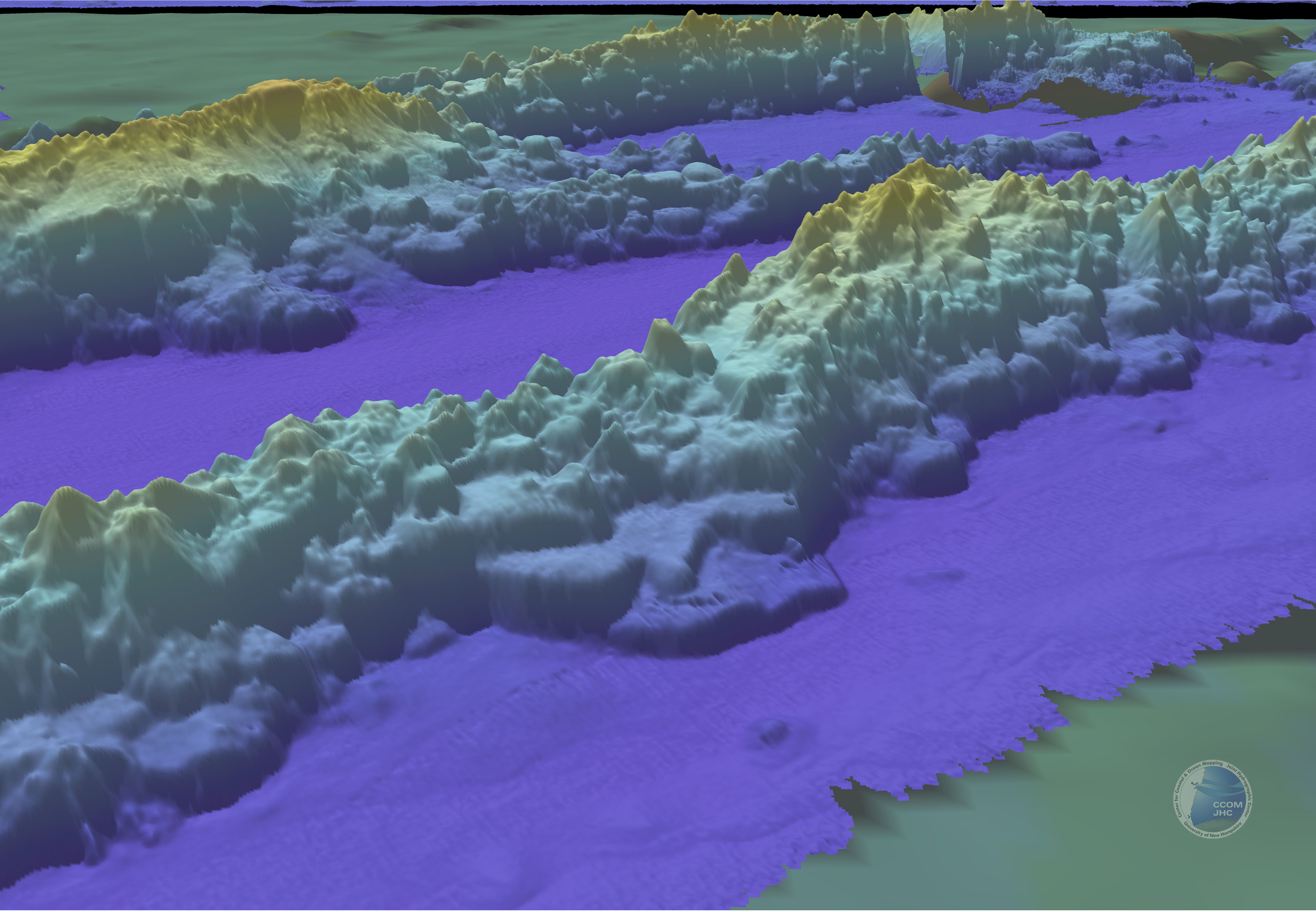
1. Necker Ridge and Foothills of the Mid-Pacific Mountains
Perspective bathymetry view of the connection of Necker Ridge and the Mid-Pacific Mountains. The main Mid-Pacific Mountains are in the background. This view shows a series of stacked volcanic flows, each 150 to 200 m thick that form the low saddle between the two features. Vertical exaggeration 5x.
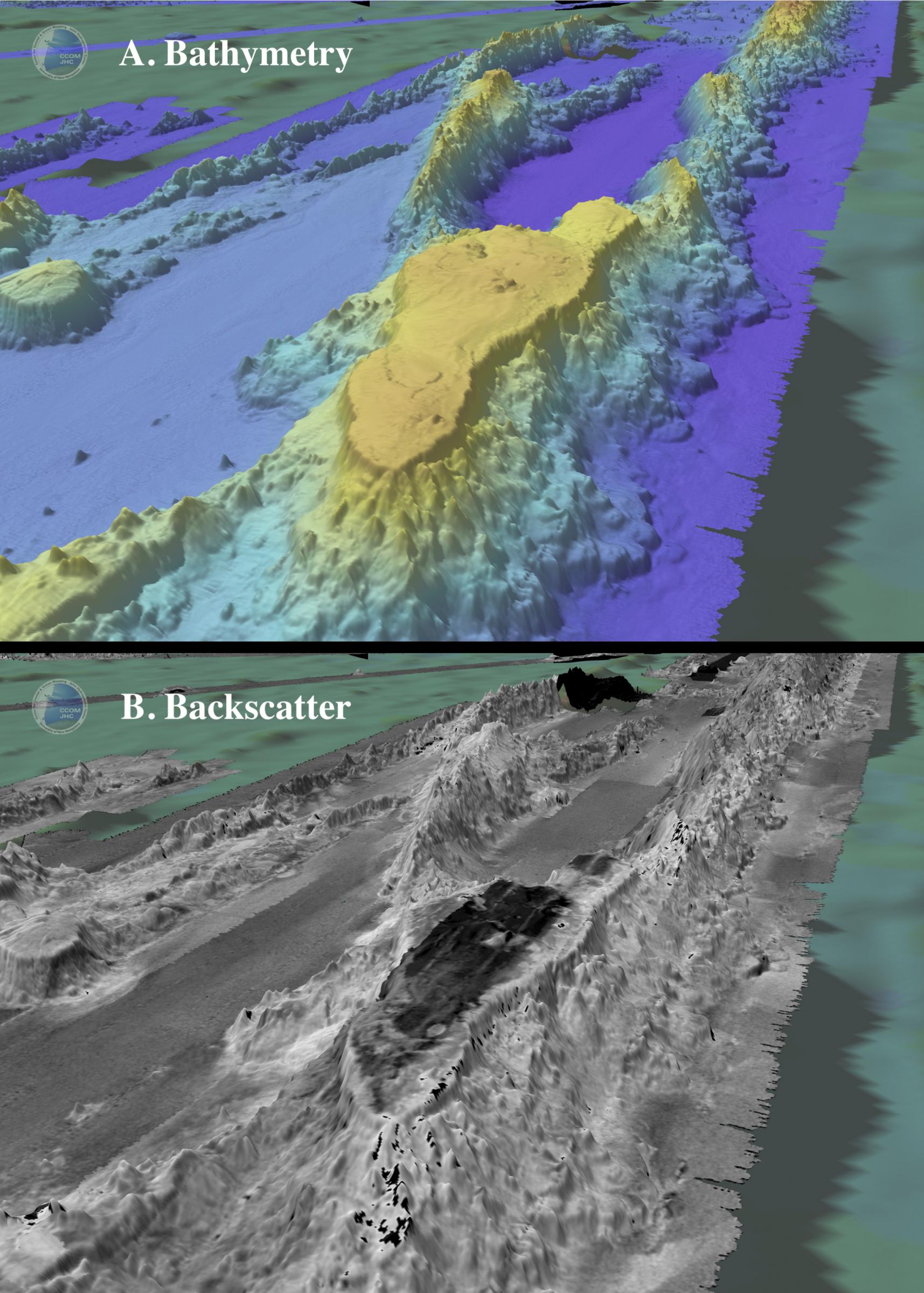
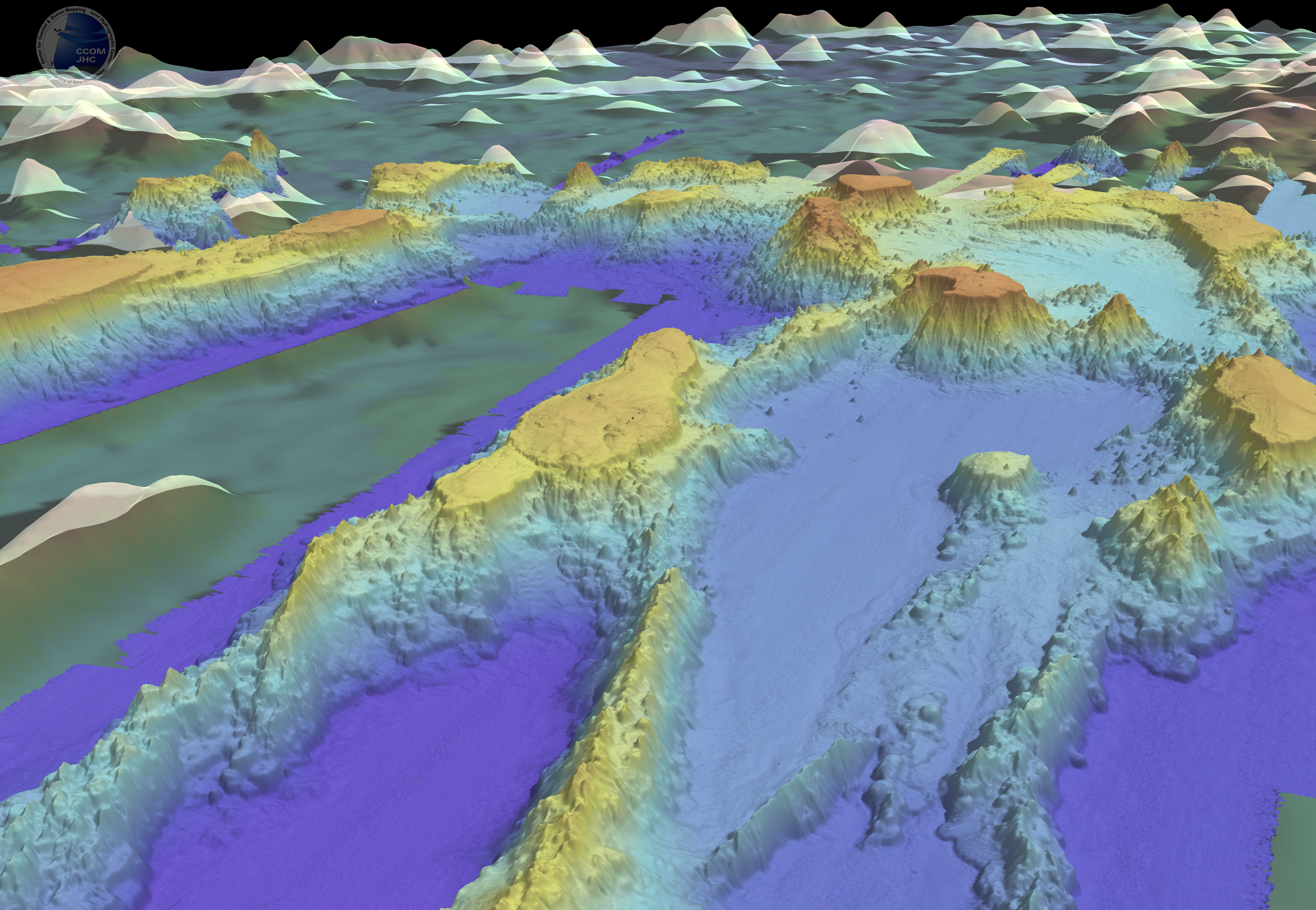
2. Necker Ridge Southern Guyot
Perspective bathymetry (a) and backscatter (b) views of southern Guyot of Necker Ridge. The upper steep (~30°) slopes appear to be formed by something other than volcanic flows (perhaps carbonates?). Notice the summit of the guyot has backscatter values similar to the abyssal seafloor and not similar to the volcanic flows of the flanks. This suggests the summit is blanketed by sediment. The flat summit of the guyot, now 2100 to 2200 m below sea level, indicates it was eroded at sea level in its past. Vertical exaggeration 5x.
3. Necker Ridge Volcanic Flows
Perspective bathymetry view of stacked volcanic flows along the central portion of Necker Ridge. These flows are 200 m to 400 m thick and have spread out 8 km from the flank of the ridge. The flows have backscatter values that suggests they are blanketed by sediment. Vertical exaggeration 5x.
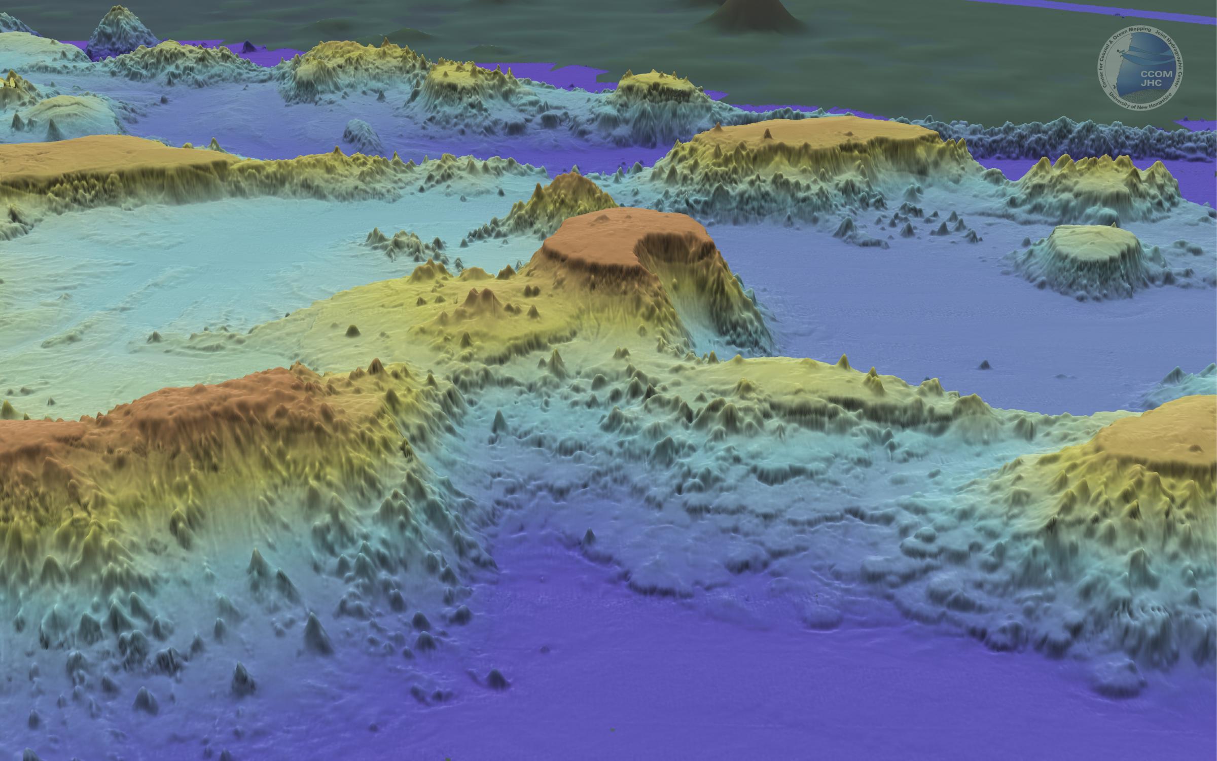
4. Necker Ridge Southern Guyot Spur
Perspective bathymetry view of spur that branches off Necker Ridge at the southern guyot. The seafloor between the spur and Necker Ridge is 4200 m deep whereas the seafloor to the NW of the spur is 5000 m deep. Vertical exaggeration 5x.
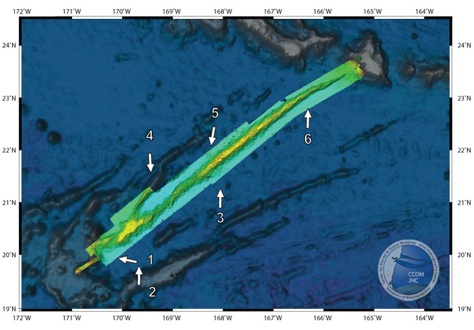
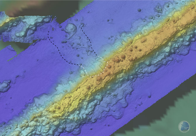
5. Necker Ridge Landslide
Map bathymetry view of landslide debris (black dashed line) and landslide scar (white dashed line) on northwestern flank of Necker Ridge. This is the only landslide found on the entire ridge.
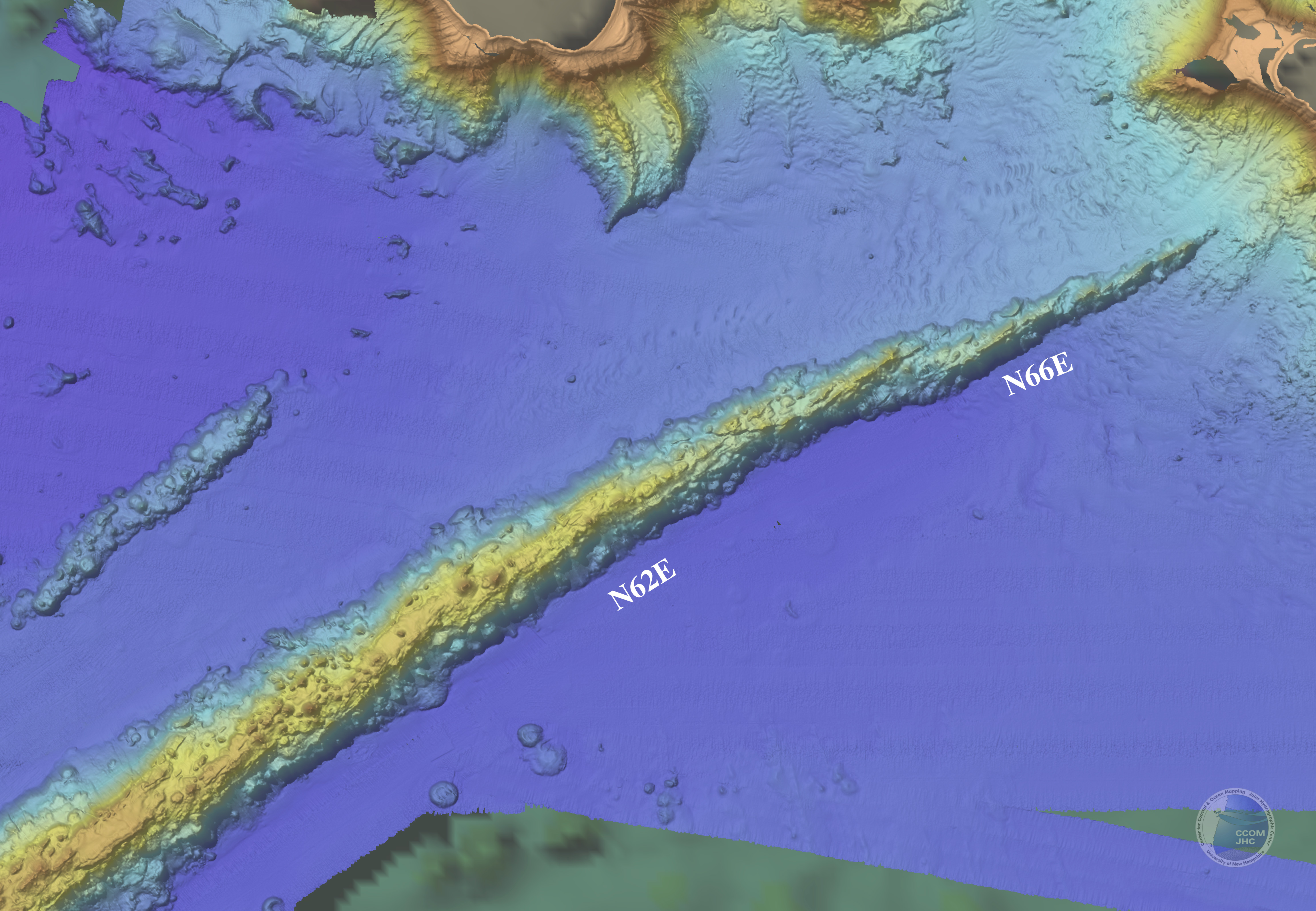
6. Necker Ridge Bend in Trend
Map view of bathymetry of northern portion of Necker Ridge showing the change in trend from N62E of the main 550 km of the ridge to N66E of the northern 120 km.