You are here
Research Areas
Research Projects
PROJECT CONTACT
Johnston Atoll, Pacific Ocean - Images
Figure 1.
Perspective view of cow pies and oceanic basement structures covered by a thin blanket of sediment. “Cow pie” is an informal term used to describe flat-topped volcanic hills that are commonly seen on the abyssal Pacific Ocean seafloor. Some cow pies have a central caldera on the summit, some do not. The cow pie in the center-left of the image has a basal diameter of 4.7 km and the summit stands 350 m above the 5300 m deep abyssal seafloor. The summit caldera has a diameter of 970 m and is ~70 m deep.
The basement ridges reflect the relief of the oceanic basement inherited by the seafloor-spreading process. The basement is blanketed by only a thin sediment cover even though the basement age is older than 83 Ma.
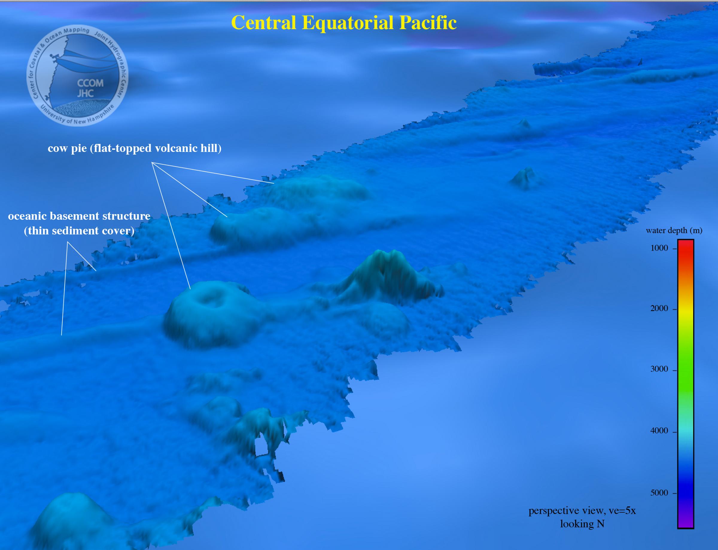
Figure 2.
Perspective view of the bathymetric gap between Karin (Sculpin) Ridge and Horizon Guyot. White dashed lines outline a 300-m high platform that spans the gap between Karin Ridge and a spur of Horizon Guyot. Cross section A-A’ trends transverse across the platform. Abyssal depths are deeper than 5200 m.
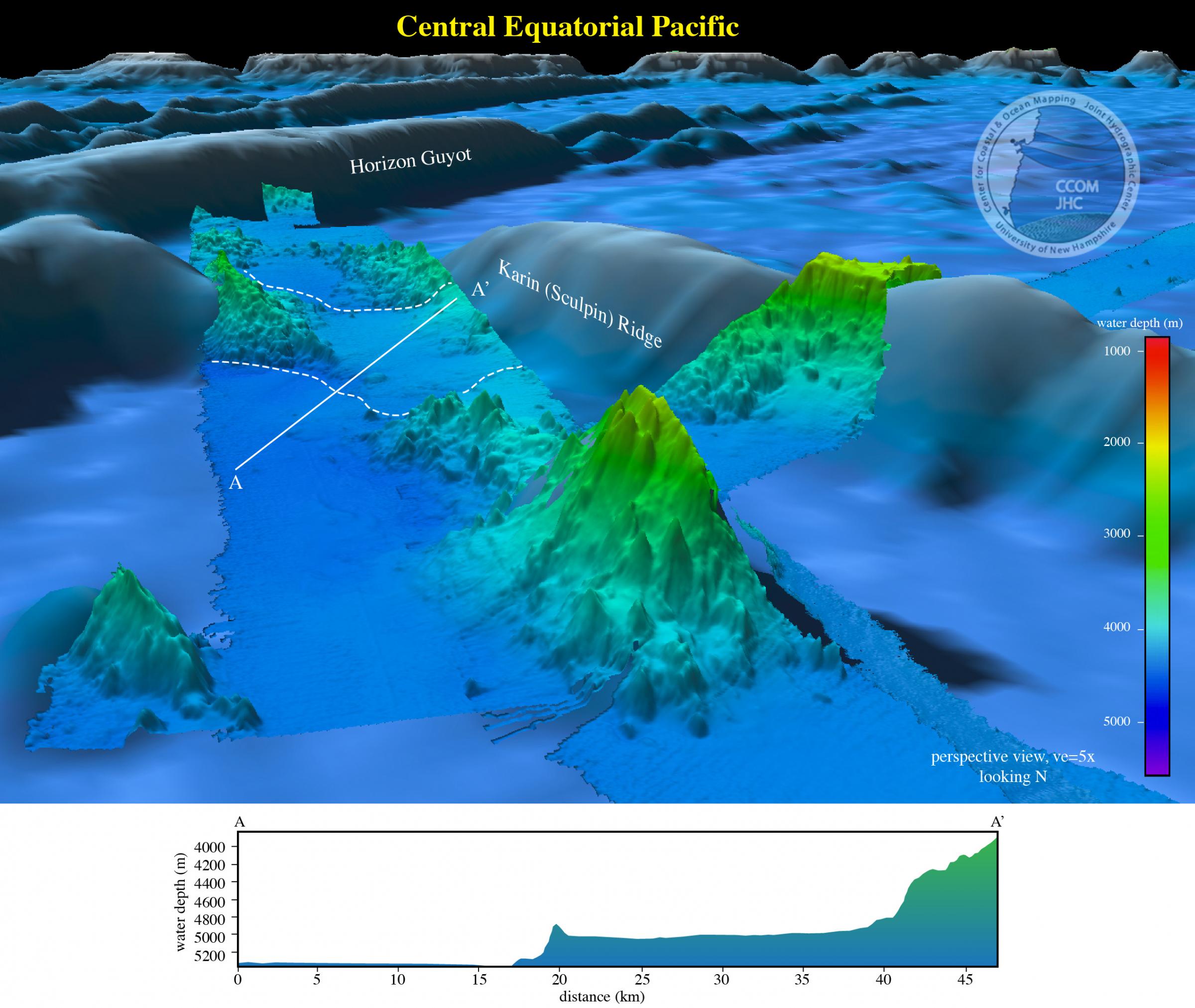
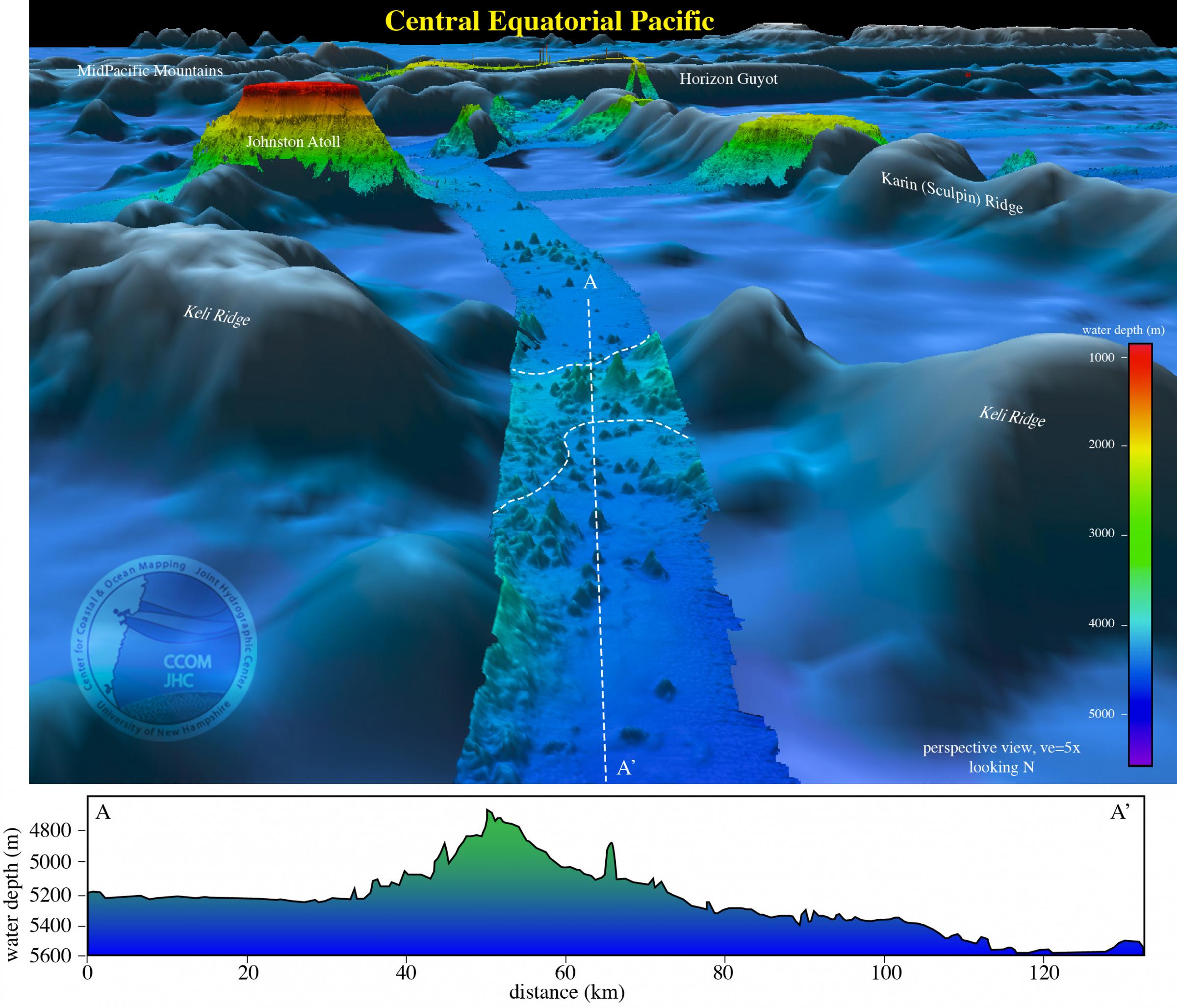
Figure 3.
Perspective view of the bathymetric gap along the trend of Keli Ridge. The white dashed line outlines a 450-m high platform that spans the gap in Keli Ridge. Cross section A-A’ trends N-S through the gap at the lowest point.