Research Areas
Research Projects
PROJECT CONTACT
Gulf of Mexico - Florida Escarpment Images
Florida Escarpment Map map for oblique view images. Arrow indicates direction of view.

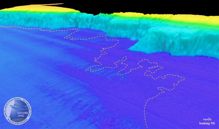
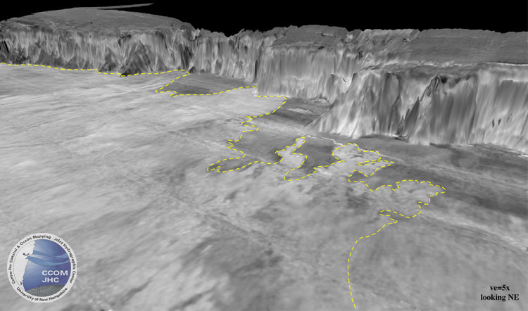
1. Mississippi Lobe Bathymetry
Perspective view of bathymetry (upper) and backscatter (lower) of the Florida Escarpment. Dashed yellow line outlines the edge of a distal lower Mississippi Fan depositional lobe (foreground) as identified from the acoustic backscatter.
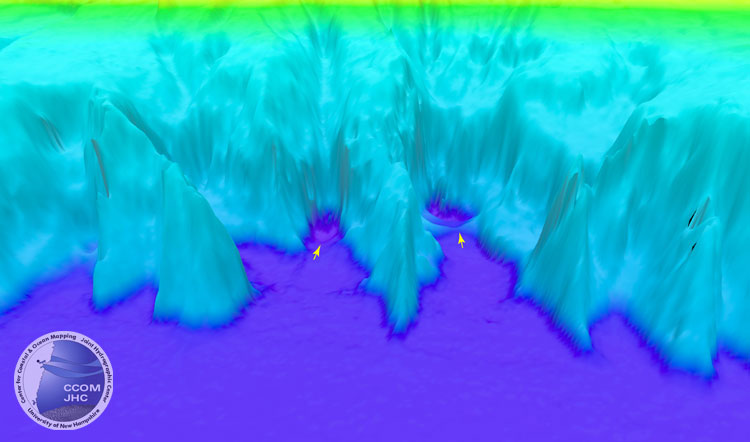
2. Plunge Pools
Perspective view of bathymetry of two "plung pools" at base of the Florida Escarpment. The pools are separated by 5.8 km and occur at the base of 2300 m of relief, some of which has slopes >40°. The pools are each >1 km in diameter and are >50 m deeper than the adjacent seafloor.
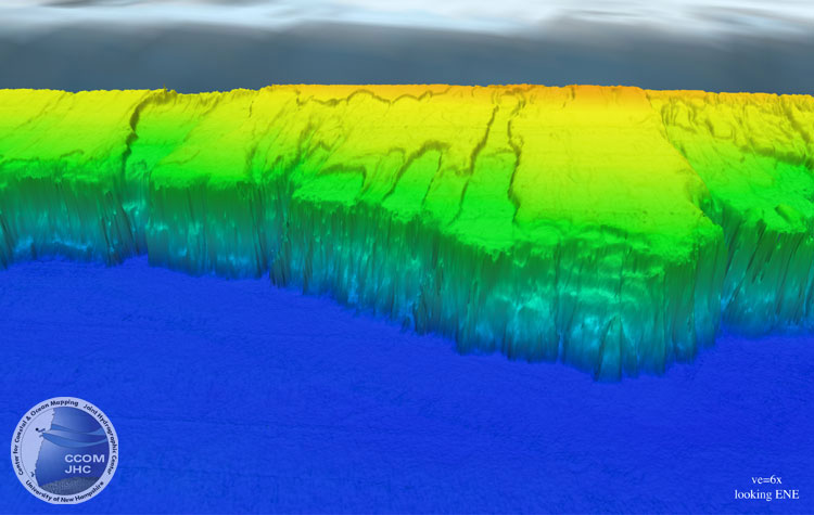
3. Slab Erosion
Oblique view of bathymetry of the central section of the Florida Escarpment. The distance across the back of the image is ~100 km. This large-scale, retrogressive-appearing erosion is typical in this section of the Florida Platform. The walls of the failures have as much as 200 m of relief.