You are here
Research Areas
Research Projects
PROJECT CONTACT
Gulf of Alaska - Images
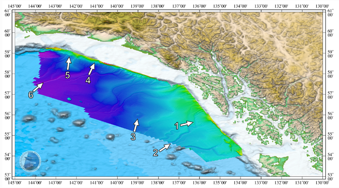
Gulf of Alaska map for oblique view images. Arrow indicates direction of view.
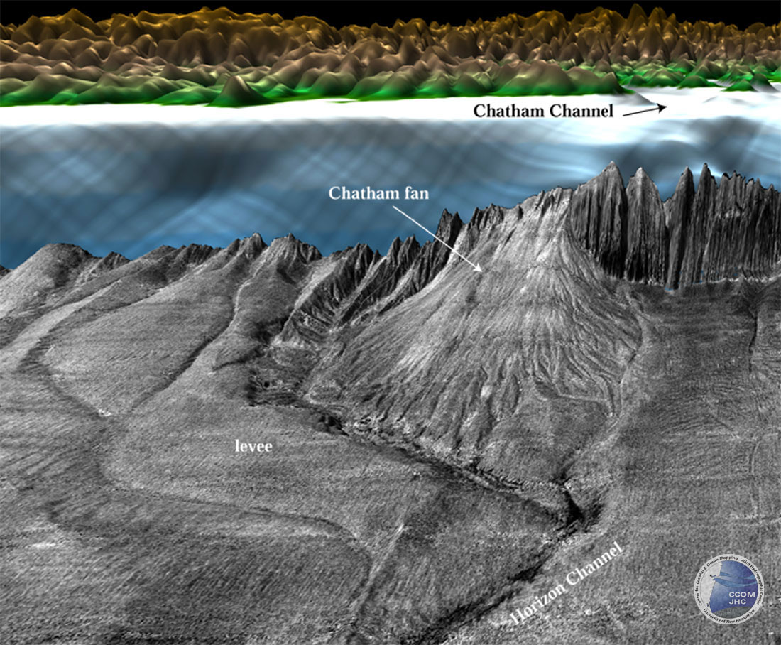
1. Chatham Fan
Perspective view of the acoustic backscatter (draped over bathymetry) of Chatham fan that lies directly offshore of Chatham Channel. Light tones are higher backscatter than darker tones. The fan extends 65 km offshore, is ~65 km at it's widest and rises ~450 m above the surrounding seafloor. The backscatter shows the numerous anastomosing channels that flow off the fan. Colored background is ETOPO2 DTM. Vertical exaggeration 20x, looking NE.
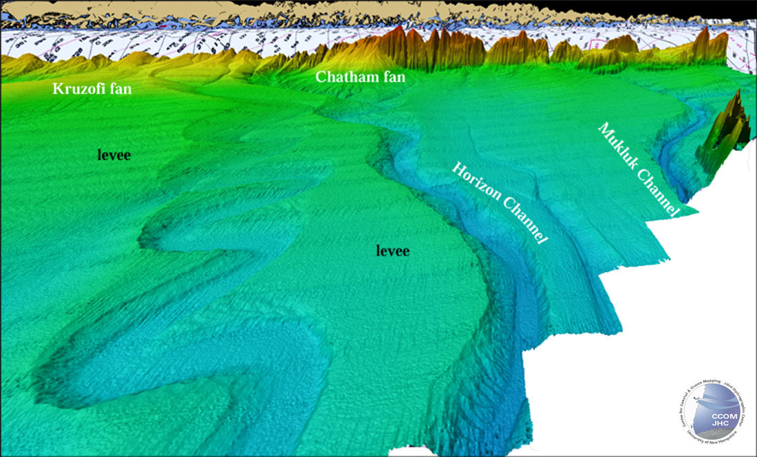
2. Horizon Channel
Perspective view of color-coded bathymetry of upper reaches of Horizon channel-levee complex. The main channel is ~3.5 km wide at its base and is incised ~120 m into the margin sediments. The large levee associated with Horizon Channel merges with the fan sediments of the Kruzofi fan complex. A huge meandering channel has cut >70 m into the levee sediments with a channel with of >4 km. The meanders have cut laterally >22 km. Distance from foreground to Chatham fan 192 km. Background behind margin is NOAA Chart 16016 draped over ETOPO2 DTM. Vertical exaggeration 15x, looking E.
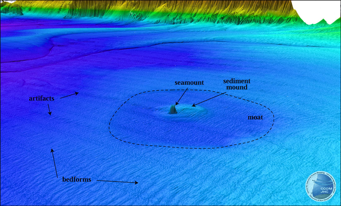
3. Seamount and Depression
Perspective view of color-coded bathymetry of almost-completely-buried seamount with associated moat (darker blue) and sediment mound (lighter blue). The seamount stands 240 m above the seafloor. It is surrounded by a sediment mound that is ~80 shallower SE of the seamount than on the NW. The entire feature is surrounded by a roughly circular moat (dashed line) 30 km in diameter. The moat is 50 m deeper and ~4 dB lower acoustic backscatter that the surrounding seafloor. The bedforms have wavelengths of ~2 km and wave heights of ~5 m. Vertical exaggeration 15x, looking E.
4. Chatter Marks
Perspective view of cascade-like landscape developed on the 5° margin. Each step of the major cascade (foreground) is a 100 to 200 m drop and the base of each step is a depression 20 to 40 m deep. Incipient cascades appears to be developing on the margin to the north (upper left in figure). 2000 and 3000-m isobaths are shown in black. Vertical exaggeration 15x, looking NE.

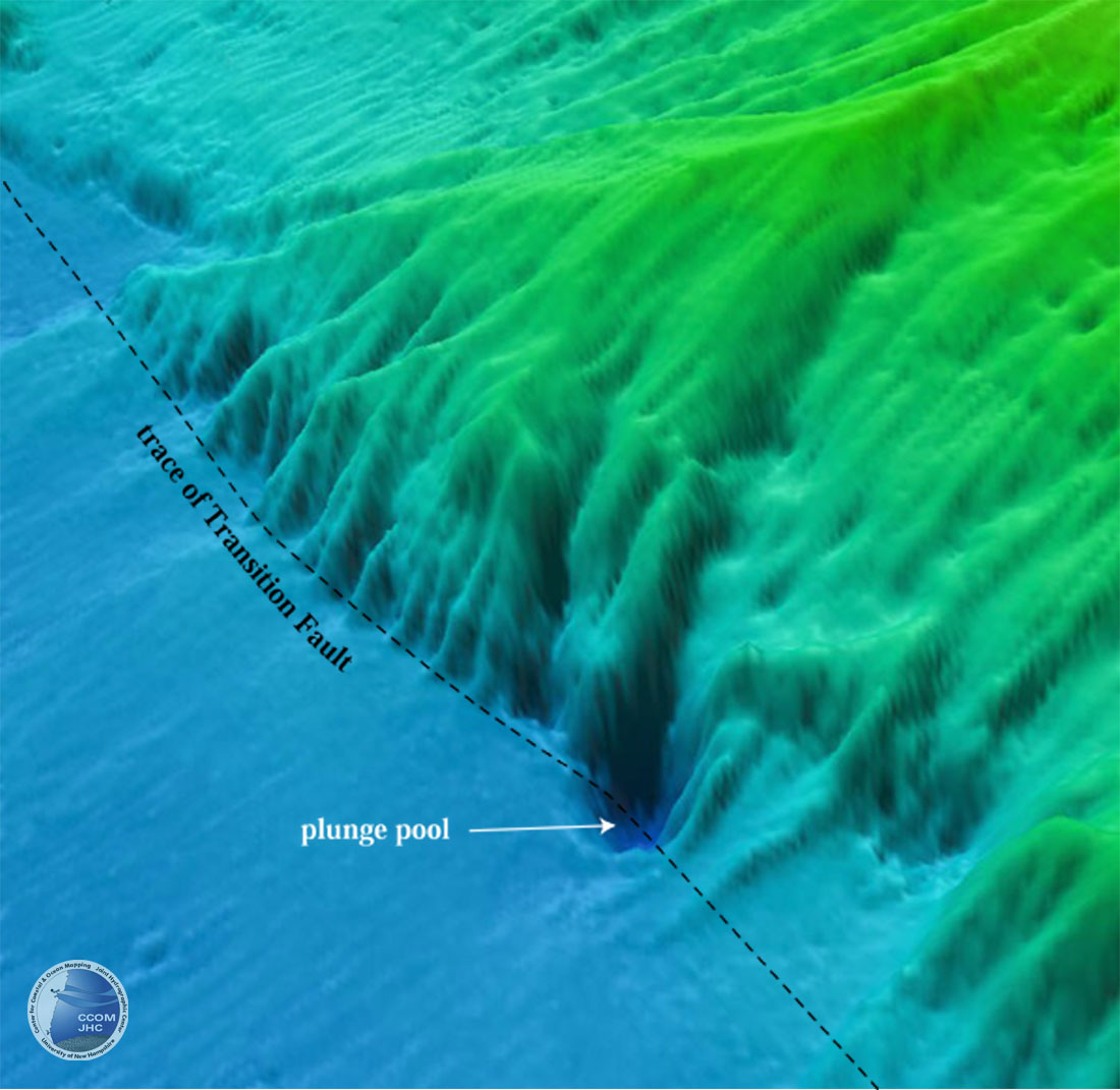
5. Plunge Pool
Perspective view of color-coded bathymetry showing the Transition Fault along the base of the margin with a 250 m deep, 500 m wide plunge pool at the end of a canyon. Vertical exaggeration 20x, looking N.
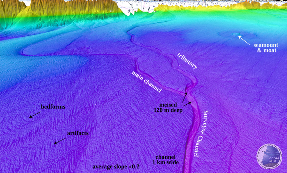
6. Surveyor Channel
Perspective view of color-coded bathymetry of upper reaches of Surveyor Channel and major tributary. Both the canyon and its tributary are incised 120 m into the margin sediments. Notice subtle differences between bedforms and artifacts. Seamount and moat are shown in another perspective view. Vertical exaggeration 15x, looking SE.