You are here
Research Areas
Research Projects
PROJECT CONTACT
Arctic Ocean Images

- Arctic Large Massif
- Arctic Possible Foot of the Slope
- Arctic Chukchi Plateau
- Arctic Healy Seamount Oblique View
- Arctic Scour Oblique View
- Arctic Pockmarks
- Arctic Barrow Margin
- North Chukchi Channel Overview
- North Chukchi Channel
- Landslides North of Chukchi
- Nautilus Basin
- North Chukchi Plateau Pockmarks
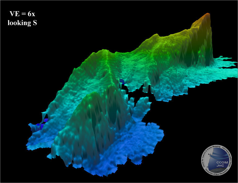
1. Arctic Large Massif
Perspective view of the bathymetry of a large massif on western side of survey. The massif is 40-km long, 16-km wide and stands ~1200 m higher than the 3250 m surrounding seafloor. The massif shows signs of large-scale landslides on its upper surface. The image has vertical exaggeration of 3x looking south. Water depth range in image 1930 m to 3300 m.
2. Arctic Possible Foot of the Slope
Perspective view of the bathymetry of the possible foot of the slope north of Chukchi Plateau. Vertical exaggeration is 3x; looking south-southwest. Water depth range in image 2880 m to 3800 m.
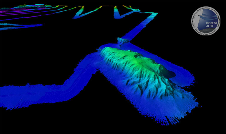
3. Arctic Chukchi Plateau
Perspective view of the bathymetry of the northern end of Chukchi Plateau with a series of bathymetric highs that extend to the north in the basin. Water depths in the basin are ~3830 m and the highs rise ~1500 m above the basin. Vertical exaggeration is 3x; looking south-southwest. Water depth range in image 1150 m to 3850 m.
4. Arctic Healy Seamount Oblique View
A newly discovered seamount in the Arctic Ocean, just north of Chukchi Cap. The seamount is 40 km long, 13 km wide and stands 2 km above the surrounding seafloor. Its steepest slopes are 38°. Water depth range in image 944 m to 3850 m.
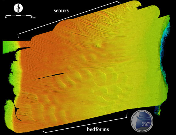
5. Arctic Scour Oblique View
Map view of a 300 km2 area of the surface of Chukchi Cap. The bedforms are asymmetrical, have wave heights of 10- to 15-m and wavelengths of 2- to 2.5-km. The orientation of the bedforms suggest a strong current flowing from NE to SW across the cap. The scours are 2- to 6-m deep and curved. The scours appear to terminate at ~430 m water depth. Water depth range in image -400m to -1400m.
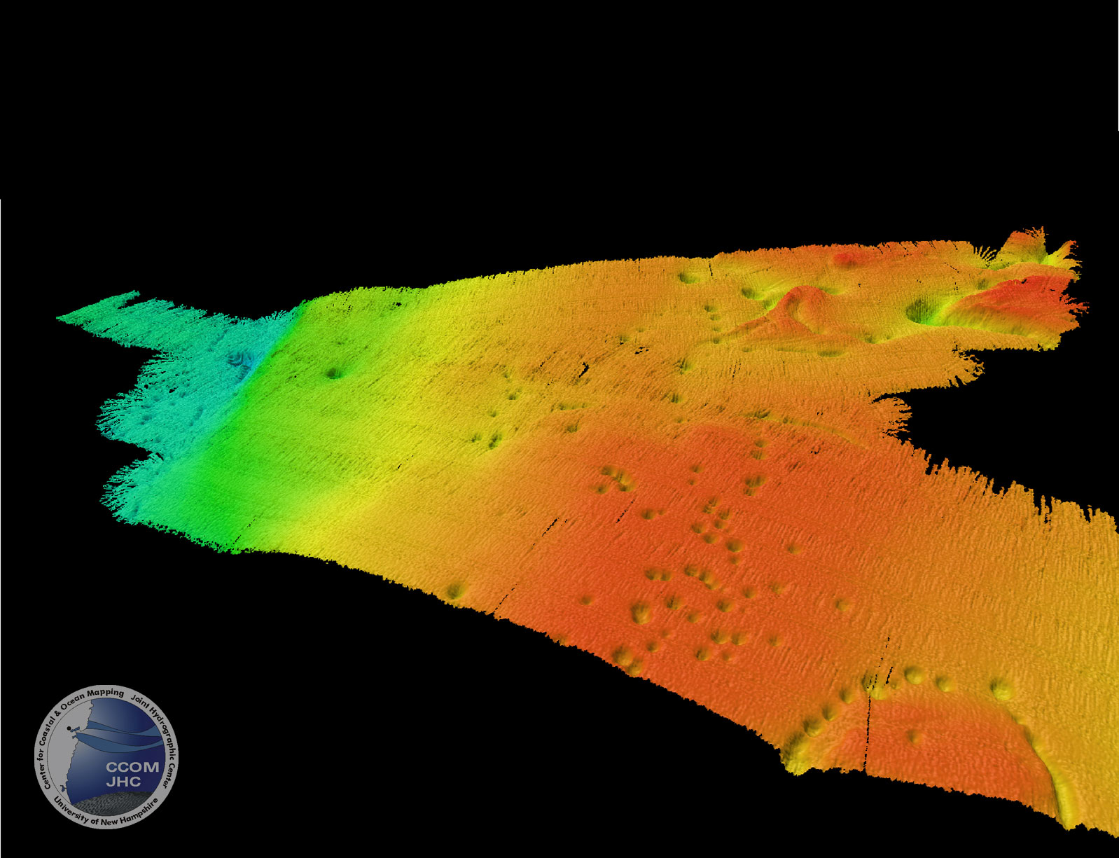
6. Arctic Pockmarks
A perspective view of gas pockmarks on the surface of Chukchi Cap. The vertical exaggeration is 10x. Individual pocks have a 200-m diameter and typically are 20- to 40-m deep. The pocks occur as both random patterns and in linear and circular patterns. Water depth range in image -500m to -850m.
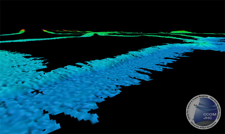
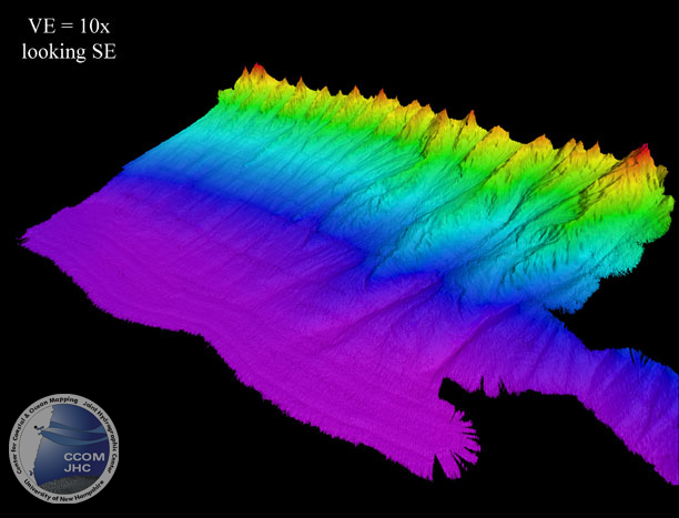
7. Arctic Barrow Margin
A perspective view of the Barrow margin, looking SE. The vertical exaggeration is 10x. The margin is composed of a series of long ridges that project from the upper margin to the basin floor. The ridges are 80 to 100 km long, 12 to 15 km wide and stand as much as 500 m high. The erosion on the ridges suggest they are composed of sediment that has been transported downslope with subsequent "drainage" systems that developed, eroding the interfluve areas. Water depth range in image -650m to -3900m.
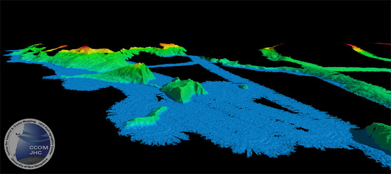
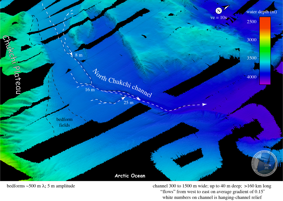
8. North Chukchi Channel Overview
Perspective view of the full 160-km long North Chukchi channel. Side channels have been captured by the main channel, leaving hanging channels (white numbers).
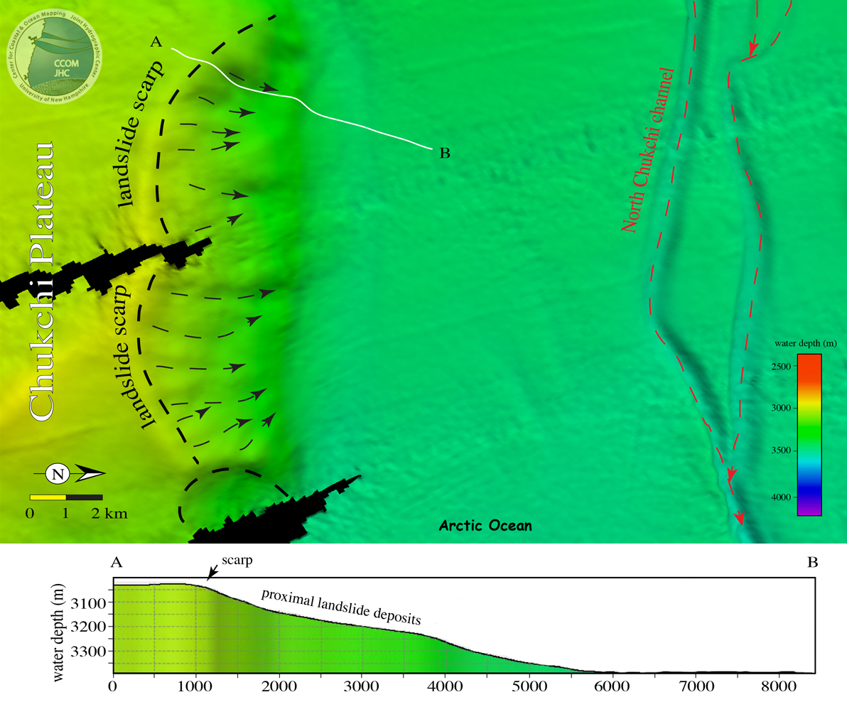
9. North Chukchi Channel
Map view (top) and profile (bottom) showing large landslide scarps (black dashed) and landslide paths (black dash with arrowheads). Also shown is a section of North Chukchi channel (red dashed) with arrowheads showing downstream thalweg direction.
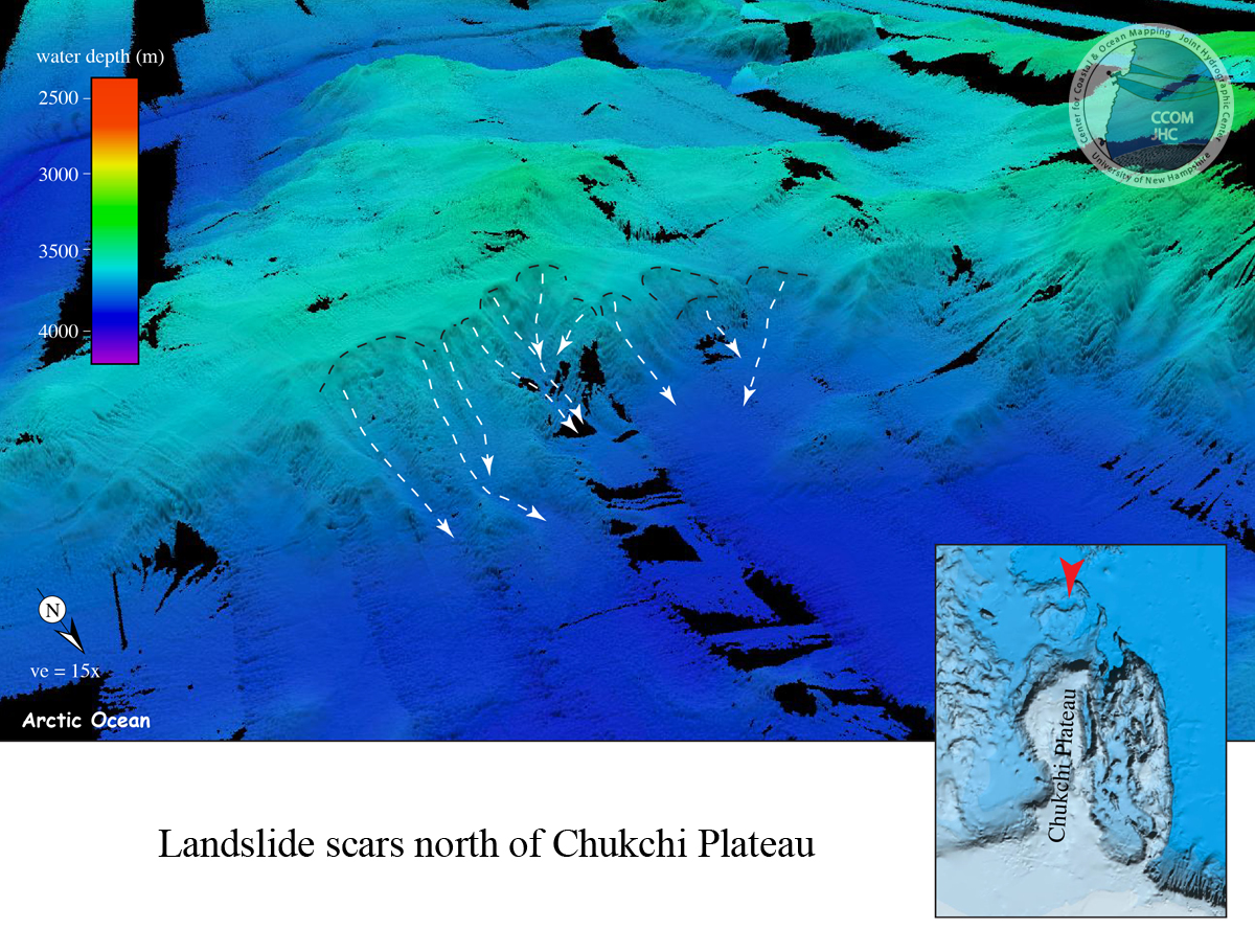
10. Landslides North of Chukchi
Perspective view of bathymetry of landslide scars along northern margin of large bathymetric high located ~150 km north of Chukchi Plateau. White dashed arrows show landslide paths.
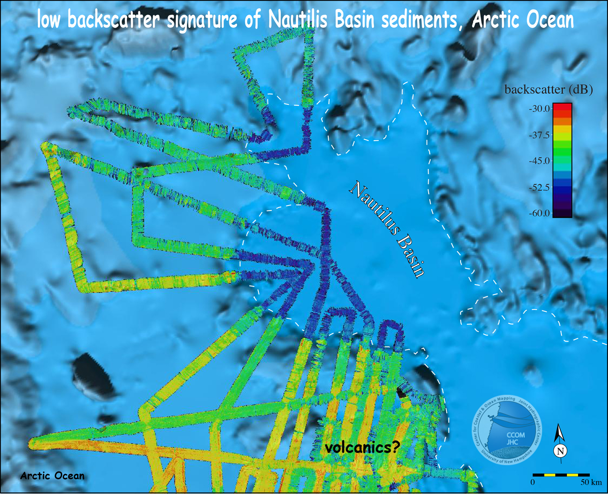
11. Nautilus Basin
Map view of Nautilus Basin and surrounding area. Background is IBCAO bathymetry and foreground is acoustic backscatter from 1202 Healy cruise. Note the distinctive low backscatter (~-53 dB) of the Nautilus Basin sediments compared to the areas shallower than the basin.
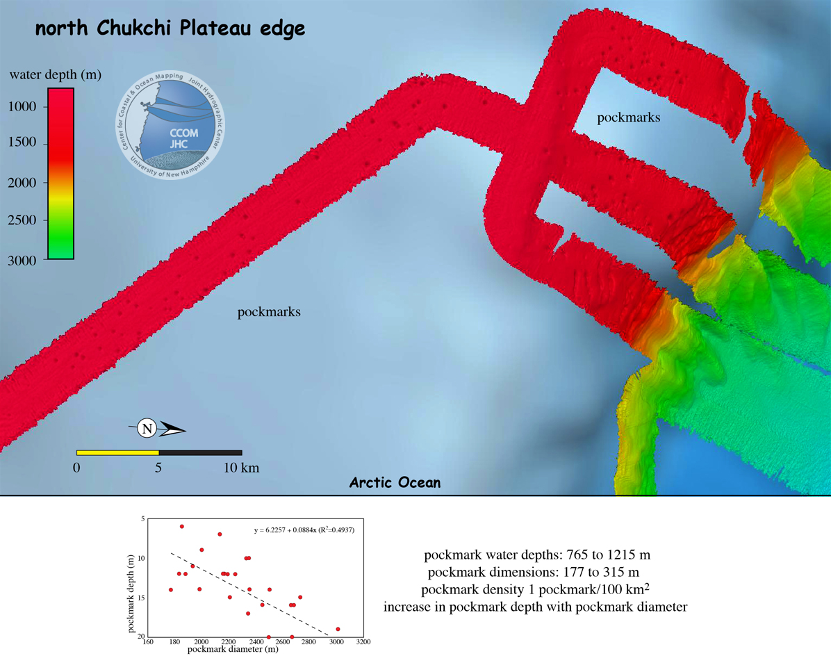
12. North Chukchi Plateau Pockmarks
Map view of HE12002 bathymetry lines on northern edge of Chukchi Plateau showing pockmarks.