United States Arctic Multibeam Compilation (v1.0).
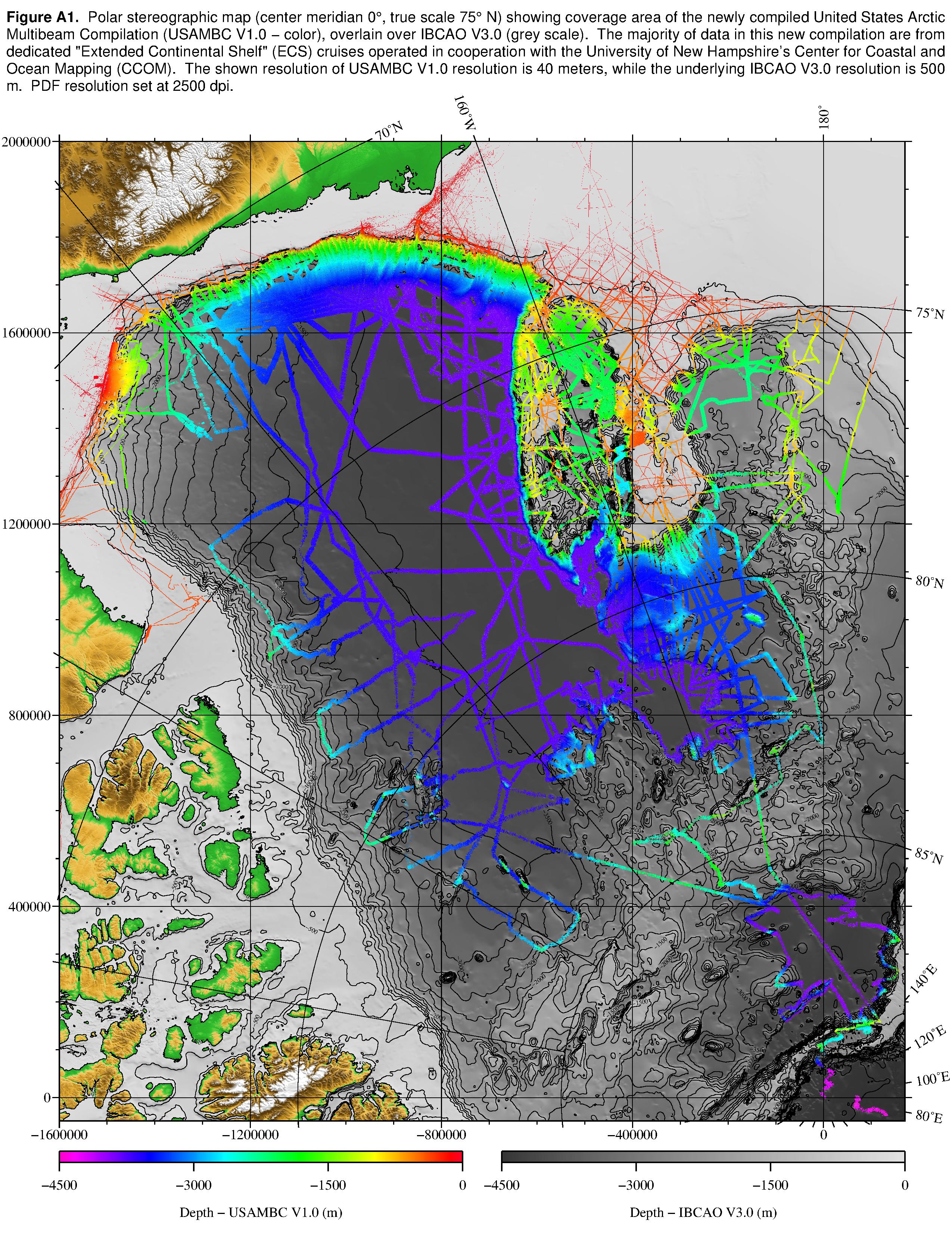
A new high-resolution multibeam bathymetry compilation for the Canada Basin and Chukchi Borderland in the Arctic Ocean - United States Arctic Multibeam Compilation (USAMBC Version 1.0). This compilation is created from multibeam data available through public repositories, preserving their native resolution and allowing for more detailed interpretation of sea floor morphology than currently possible with other large-scale compilations. Much of the new new data was collected through dedicated mapping cruises in support of the United States effort to map extended continental shelf regions beyond the 200 nm Exclusive Economic Zone. Data quality was evaluated using nadir beam crossover error statistics, and compiled into a high-resolution grid through a weighted vertical stacking algorithm. Both the gridded compilation and an easily-distributed PDF is freely available through the University of New Hampshire's Center for Coastal and Ocean Mapping
This data is subject to our standard disclaimer on liability and warranties, and our standard copyright statement. You can find both of these here.
| Attachment | Size |
|---|---|
| 1.04 GB | |
| 372.54 MB | |
| 425.62 MB |


